
WeatherCloud utilizes vehicles as weather sensors and combines that data with high-density stationary weather stations to produce the largest, most accurate surface weather model on the planet.
WeatherCloud offers a statistically-based machine learning road weather forecast system. This provides more accurate and scalable road weather information for end users than physical models, enabling sub kilometer forecasts and alerts.
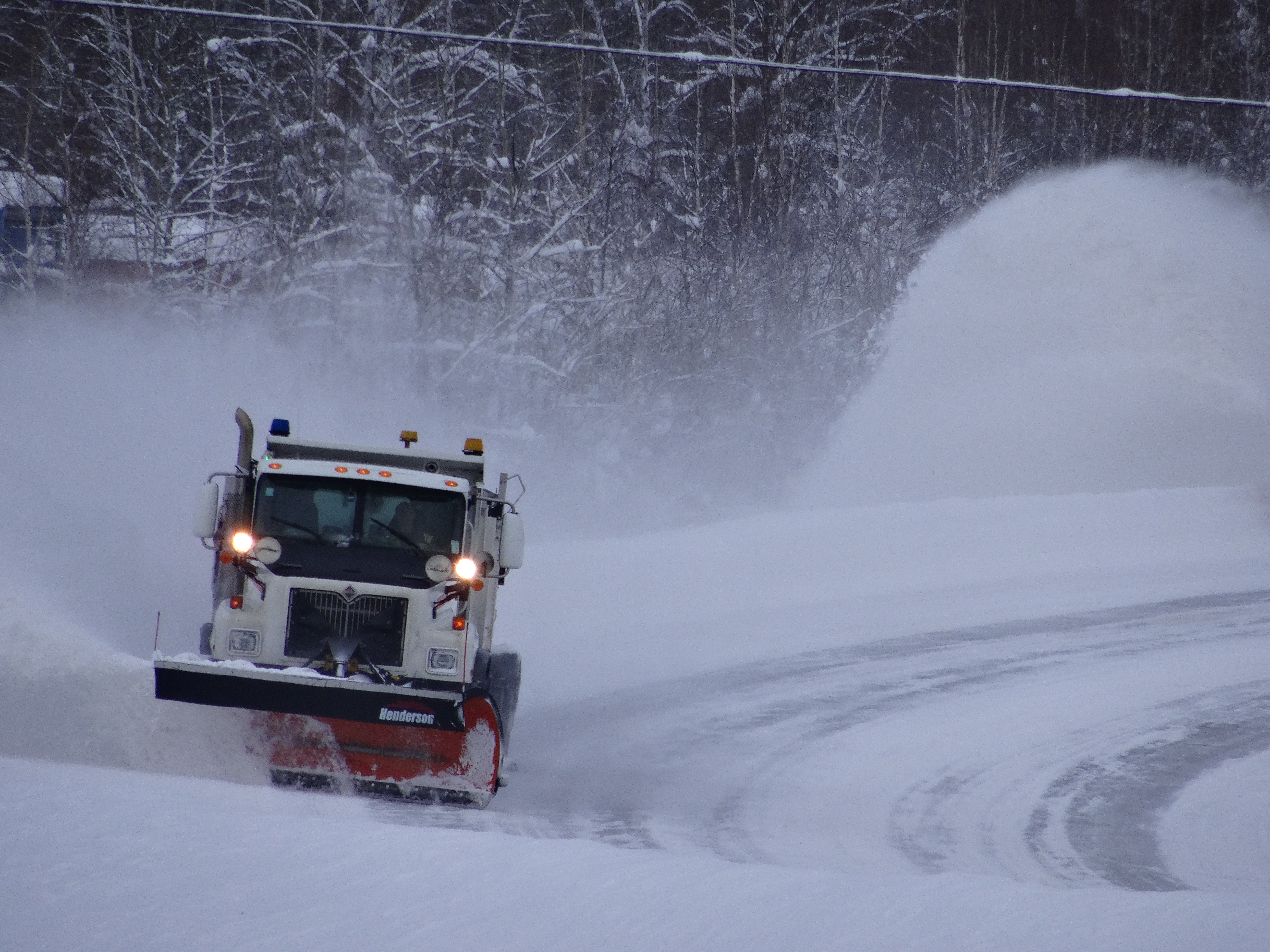
Vehicle-mounted sensors measure ambient temperature, wind direction and velocity, precipitation rate and type, pavement temperature and conditions (wet, icy, snow packed), relative humidity, and visibility. These sensors feed the data to an on-board field gateway device.
![]()
High-density WeatherMesh stations collect weather conditions, including wind speed, wind direction, rainfall, fog and air quality. Stations are meshed via a radio network and communicate via cellular, Wi-Fi or satellite. WeatherMesh stations are fully configurable.
![]()
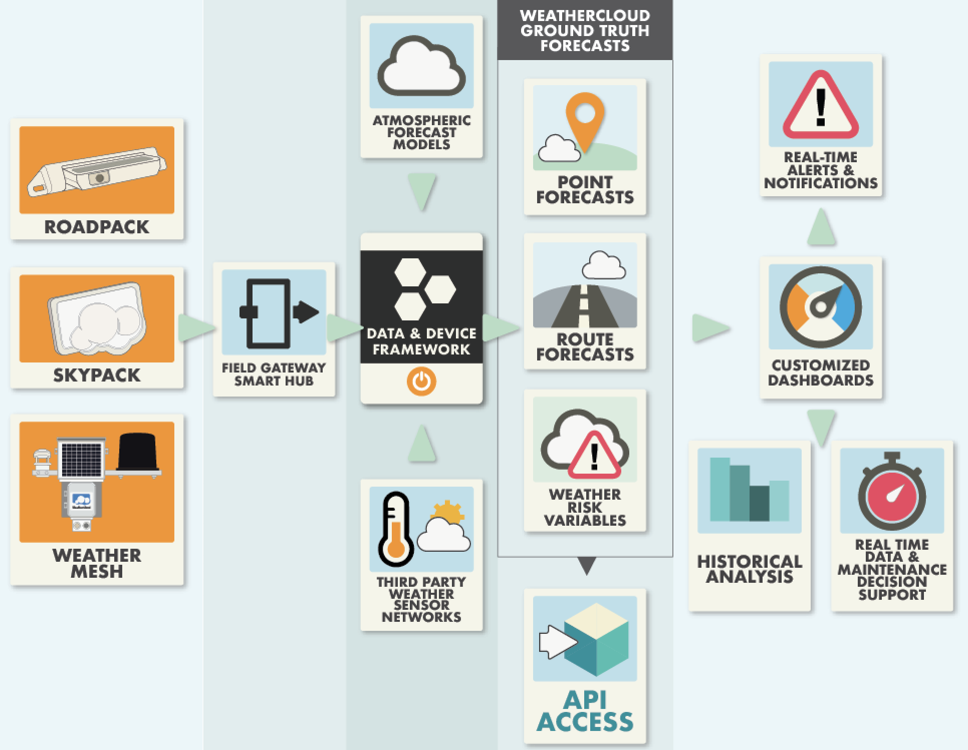
The Field Gateway streams the data to the cloud where it is combined with meteorological models and third party sensor networks to create precise, granular descriptions of weather and road conditions at the earth’s surface. We call this Ground Truth.
![]()
Ground Truth data is accessed through WeatherCloud apps and dashboards (desktop, tablet and mobile) and can be pushed back to drivers and maintenance personnel as alerts, routes and forecasts.
The Forecasts
Ground Truth forecasts combine trusted weather models with observational sensor data and pavement models to deliver highly-accurate, hyper-local road and ground conditions.All forecasts and tiled images are available via APIs.
Point Forecasts
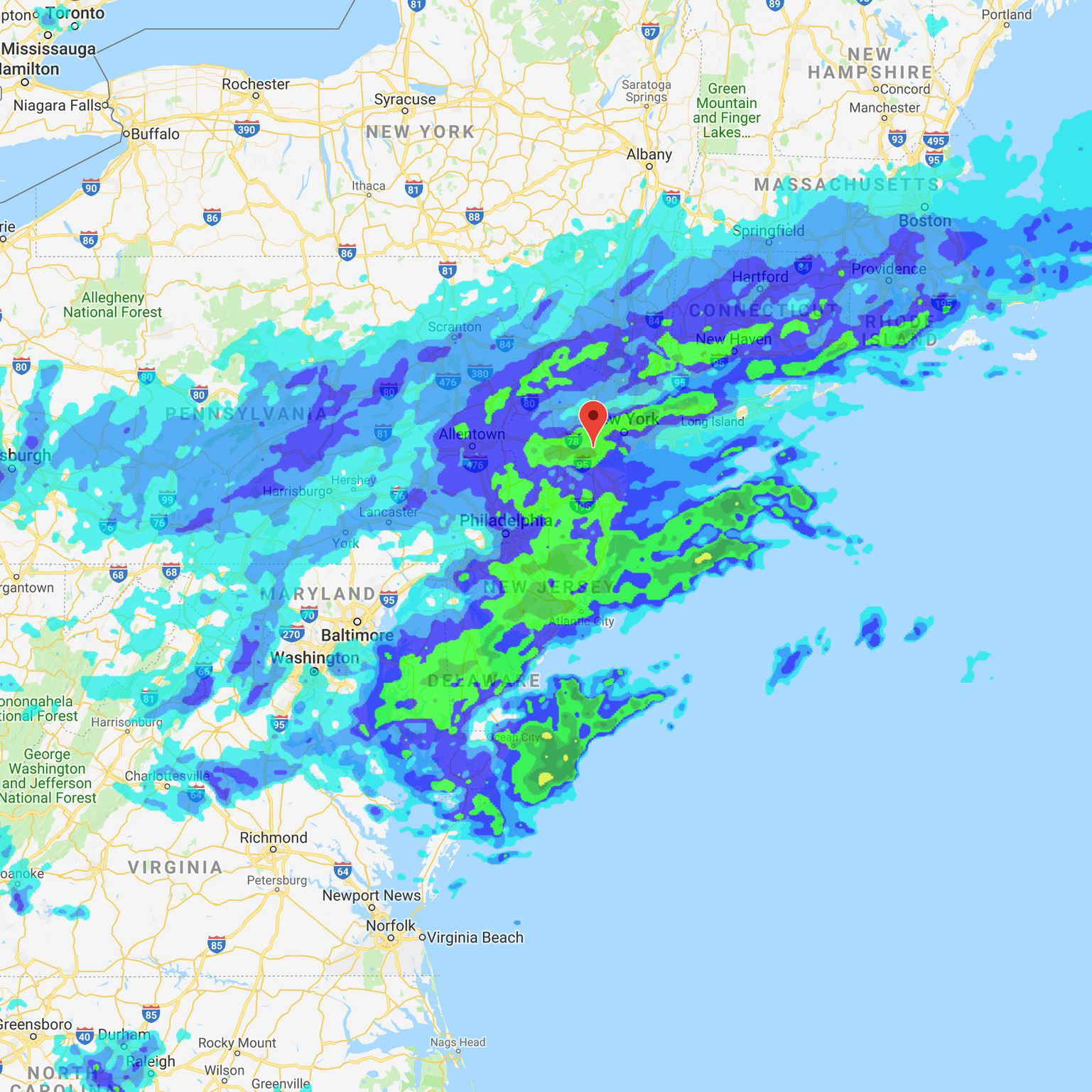
Point Forecasts give both the current and forecasted weather on the road and above for any point on the map identifiable with a latitude and longitude.
Route Forecasts
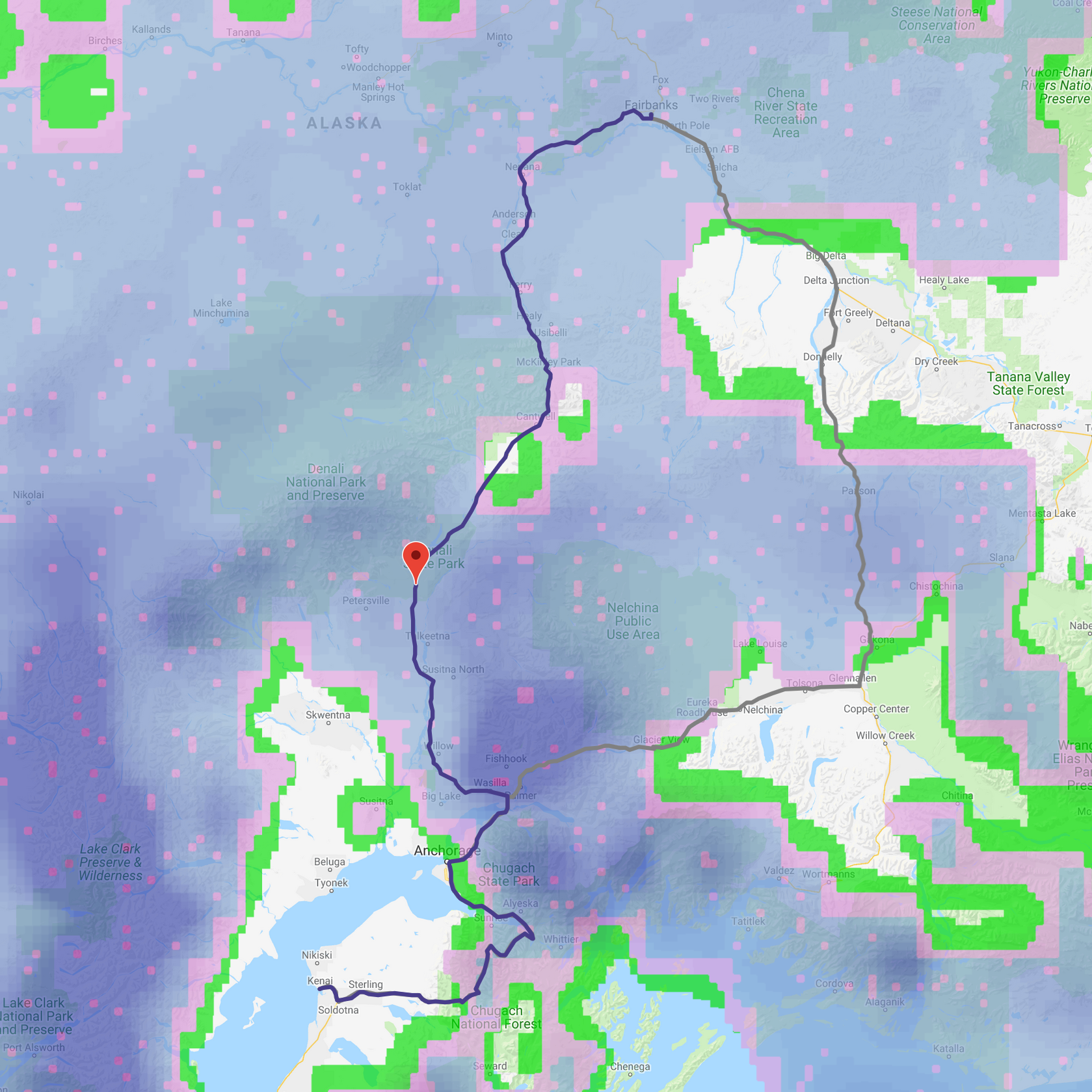
The Route Forecast interprets weather conditions and gives road condition forecasts for any user-specified route on the globe. It can fully integrate with existing mapping or route optimization tools.
Weather Risk Variables
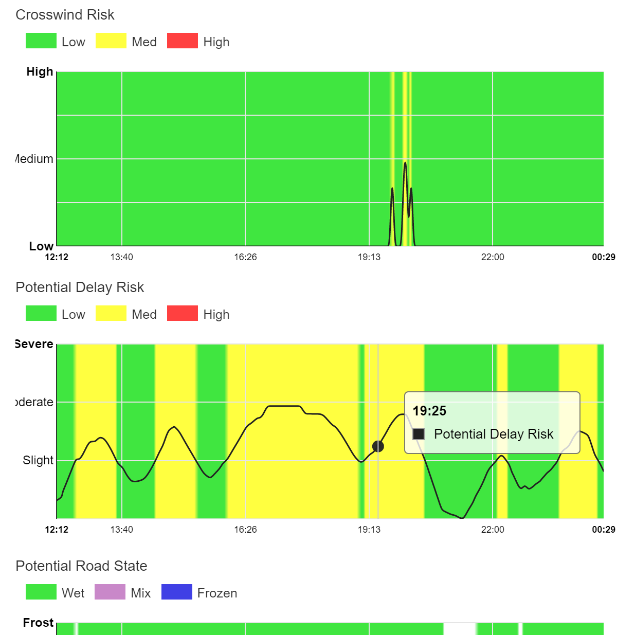
WeatherCloud's value-added forecasts address specific roadway and route-specific risks, including crosswinds, delay probability, slick roads, flash floods, low visibility, hydroplane risk, estimated wheel slip and more.
The Sensors
Ground Truth sensors attach to vehicles and existing road infrastructure to measure over 40 critical environmental data elements. What is the current rate of precipitation? Is the temperature dropping quickly? Are there unusual amounts of water building up on the road? WeatherCloud sensors deliver the answers – and fast.Ground Truth Skypack
The Skypack is affixed to the inside of the windshield. This sensor measures precipitation rate and type, and ambient lighting conditions.
The Skypack contains a precipitation sensor, an ambient light sensor, microcontroller, BLE modem, LiPo battery, and solar cell.
Ground Truth Roadpack
The Roadpack is attached to the license plate frame. The Roadpack measures dew point, ambient temperature, pavement temperature and road conditions such as wet, icy or snow-packed and is programmed to determine crosswinds.
The Roadpack contains an IMU, infrared thermometer, microphone, BLE modem, LiPo battery, and solar cell.
Ground Truth WeatherMesh
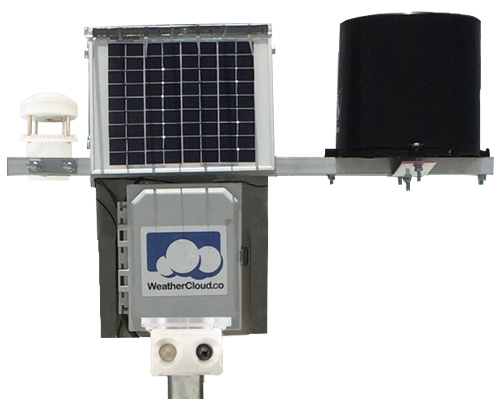
WeatherCloud's high-density WeatherMesh provide 10 to 1 coverage as compared to traditional RWIS. They are radio-meshed and can be installed on existing infrastructure, such as light poles. WeatherMesh stations are modular, meaning you decide which attributes are important to track.
WeatherMesh stations collect all Roadpack and Skypack data elements, as well as wind speed and direction, rain fall and visibility. Camera is optional.
The Data
Ground Truth data is available in easy-to-view apps and dashboards available from any device, including desktop, tablet or mobile. Alerts based on any combination of data can be pushed out to the drivers or personnel.Field Gateway App
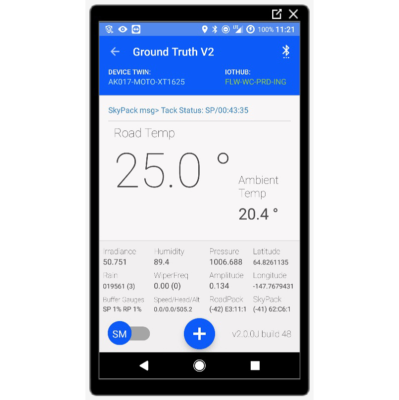
The Field Gateway aggregates the data collected by the sensors and adds vehicle dynamics data collected by the gateway itself. It then crunches the data and pushes it to the cloud. Mobile apps display all immediately relevant road condition data.
Dashboards
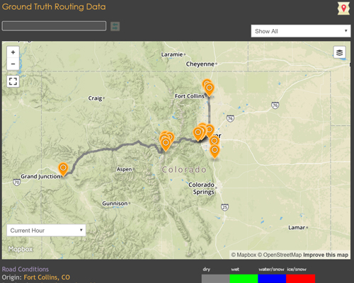
Data is ported into data dashboards to track vehicles and road weather in real-time. Dashboards can be configured with the visualizations that best fit your needs. Dashboards can be customized for each user or role within an organization. All dashboards are available via PC, tablet or mobile.
Alerts & Notifications
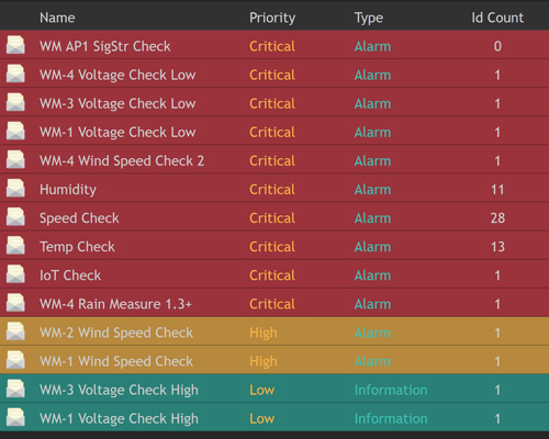
Dashboards allow for data-triggered SMS and email alerts to better manage driver warnings and maintenance operations. Alerts can be set up based on any combination of incoming data elements, including road temperature and geo-fence. Notifications are displayed by priority.